
Drones Help Track Nests
Researchers use robots to survey and conserve breeding water birds.

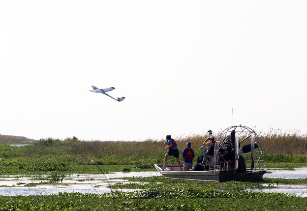
Tracking birds is never very easy, but biologists are getting a lift from some unexpected technology: drones. Researchers at the University of Florida build the gadgets for conservation research, including aerial surveys of the state’s many nesting water birds. “Some colonies have upwards of 20,000 nests and may be two miles long,” says research professor Peter Frederick. The drones fly temporarily autonomous fixed routes, snapping thousands of pictures with unique GPS stamps. A computer stitches the photos together, allowing scientists to pinpoint every bird during nesting season. The images are so detailed that Frederick can spot individual eggs and lurking alligators. One recent flight surveyed pelicans on Seahorse Key on Florida’s Gulf Coast, among other things. More wildlife biologists will use drones as the technology improves and gets cheaper, predicts Frederick. “They can do things that we have never been able to do before.”
This story originally ran in the May-June 2013 issue as "I Spy."